
Thank you for supporting this site ❤️
Make a donation
Make a donation
Cowper Lake topographic map
Click on the map to display elevation.
Thank you for supporting this site ❤️
Make a donation
Make a donation
About this map
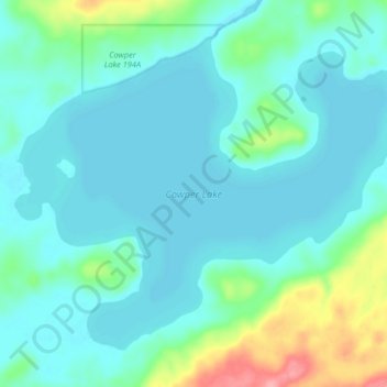
Name: Cowper Lake topographic map, elevation, terrain.
Location: Cowper Lake, Wood Buffalo, Alberta, Canada (55.87624 -110.49198 55.92068 -110.39389)
Average elevation: 482 m
Minimum elevation: 463 m
Maximum elevation: 564 m
Thank you for supporting this site ❤️
Make a donation
Make a donation
Other topographic maps
Click on a map to view its topography, its elevation and its terrain.