
Chaîne de l'Oberhalbstein topographic map
Interactive map
Click on the map to display elevation.
About this map
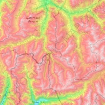
Name: Chaîne de l'Oberhalbstein topographic map, elevation, terrain.
Location: Chaîne de l'Oberhalbstein, Ferrera, Viamala, Grisons, Suisse (46.30807 9.32123 46.71259 9.66087)
Average elevation: 2,032 m
Minimum elevation: 288 m
Maximum elevation: 3,361 m