
Thank you for supporting this site ❤️
Make a donation
Make a donation
Perumathunallur topographic map
Click on the map to display elevation.
Thank you for supporting this site ❤️
Make a donation
Make a donation
About this map
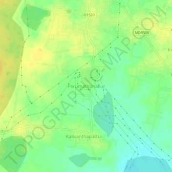
Name: Perumathunallur topographic map, elevation, terrain.
Location: Perumathunallur, Chengalpattu, Tamil Nadu, 600007, India (12.76666 80.05521 12.80666 80.09521)
Average elevation: 42 m
Minimum elevation: 29 m
Maximum elevation: 53 m
Thank you for supporting this site ❤️
Make a donation
Make a donation
Other topographic maps
Click on a map to view its topography, its elevation and its terrain.
Thank you for supporting this site ❤️
Make a donation
Make a donation
Thank you for supporting this site ❤️
Make a donation
Make a donation