
Atsinanana topographic map
Interactive map
Click on the map to display elevation.
About this map
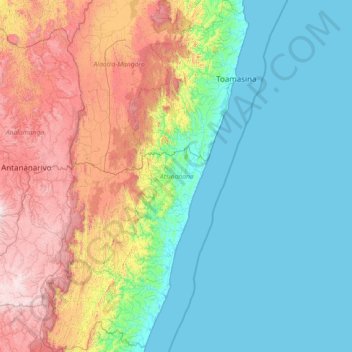
Name: Atsinanana topographic map, elevation, terrain.
Location: Atsinanana, Province de Tamatave, Madagaskar (-20.47019 47.64774 -17.48421 49.52036)
Average elevation: 484 m
Minimum elevation: -1 m
Maximum elevation: 2,097 m
Other topographic maps
Click on a map to view its topography, its elevation and its terrain.
Befotaka
Madagaskar > Atsinanana > Befotaka
Befotaka, District de Mahanoro, Atsinanana, Province de Tamatave, Madagaskar
Average elevation: 269 m