
Thank you for supporting this site ❤️
Make a donation
Make a donation
Westerly topographic map
Click on the map to display elevation.
Thank you for supporting this site ❤️
Make a donation
Make a donation
About this map
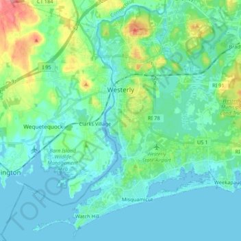
Name: Westerly topographic map, elevation, terrain.
Location: Westerly, South County, Rhode Island, 02808, United States (41.30358 -71.89242 41.41992 -71.73078)
Average elevation: 19 m
Minimum elevation: -3 m
Maximum elevation: 98 m
Thank you for supporting this site ❤️
Make a donation
Make a donation
Other topographic maps
Click on a map to view its topography, its elevation and its terrain.