
Hochthron topographic map
Interactive map
Click on the map to display elevation.
About this map
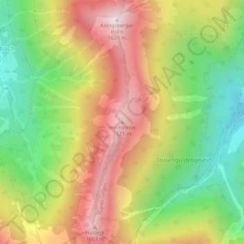
Name: Hochthron topographic map, elevation, terrain.
Average elevation: 1,155 m
Minimum elevation: 735 m
Maximum elevation: 1,606 m
Other topographic maps
Click on a map to view its topography, its elevation and its terrain.
Wolfgangsee
Österreich > Salzburg > Bezirk Salzburg-Umgebung > Sankt Gilgen
Wolfgangsee, Sankt Gilgen, Bezirk Salzburg-Umgebung, Salzburg, 5340, Österreich
Average elevation: 844 m
Zwölferhorn
Österreich > Salzburg > Bezirk Salzburg-Umgebung > Sankt Gilgen
Zwölferhorn, Sankt Gilgen, Bezirk Salzburg-Umgebung, Salzburg, 5340, Österreich
Average elevation: 1,138 m