
Thank you for supporting this site ❤️
Make a donation
Make a donation
Uchubamba topographic map
Click on the map to display elevation.
Thank you for supporting this site ❤️
Make a donation
Make a donation
About this map
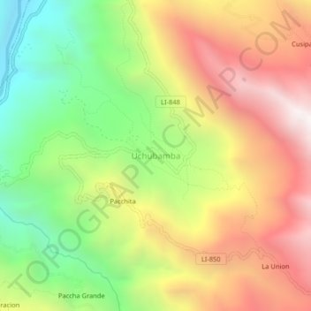
Name: Uchubamba topographic map, elevation, terrain.
Location: Uchubamba, Chugay, Sánchez Carrión, La Libertad, Perú (-7.74677 -77.86353 -7.70677 -77.82353)
Average elevation: 2,758 m
Minimum elevation: 1,910 m
Maximum elevation: 3,648 m
Thank you for supporting this site ❤️
Make a donation
Make a donation
Other topographic maps
Click on a map to view its topography, its elevation and its terrain.