
Thank you for supporting this site ❤️
Make a donation
Make a donation
Upper Moutere topographic map
Click on the map to display elevation.
Thank you for supporting this site ❤️
Make a donation
Make a donation
About this map
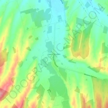
Name: Upper Moutere topographic map, elevation, terrain.
Location: Upper Moutere, Tasman, 7175, New Zealand (-41.28948 172.98642 -41.24948 173.02642)
Average elevation: 97 m
Minimum elevation: 49 m
Maximum elevation: 178 m
Thank you for supporting this site ❤️
Make a donation
Make a donation
Other topographic maps
Click on a map to view its topography, its elevation and its terrain.