
Ait Sedrate Jbel El Soufla topographic map
Interactive map
Click on the map to display elevation.
About this map
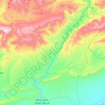
Name: Ait Sedrate Jbel El Soufla topographic map, elevation, terrain.
Average elevation: 2,109 m
Minimum elevation: 1,431 m
Maximum elevation: 3,322 m
Other topographic maps
Click on a map to view its topography, its elevation and its terrain.
Ait Sedrate Jbel El Oulia
Maroc > cercle de Boulmane-Dadès
Ait Sedrate Jbel El Oulia, caïdat d'Aït Sedrate Jbel, Cercle de Boulmane-Dadès, Province de Tinghir, Drâa-Tafilalet, Maroc
Average elevation: 2,571 m
Ait Ishaq
Maroc > cercle de Boulmane-Dadès
Ait Ishaq, Ait Youl, caïdat d'Aït Sedrate Jbel, cercle de Boulmane-Dadès, Province de Tinghir, Drâa-Tafilalet, 45159, Maroc
Average elevation: 1,697 m