
Thank you for supporting this site ❤️
Make a donation
Make a donation
Mahendragiri topographic map
Click on the map to display elevation.
Thank you for supporting this site ❤️
Make a donation
Make a donation
Mahendragiri
Mahendragiri, is a mountain in Rayagada block of the district of Gajapati, Odisha, India. It is situated amongst the Eastern Ghats at an elevation of 1,501 metres (4,925 ft). The second highest mountain of Odisha.
Thank you for supporting this site ❤️
Make a donation
Make a donation
About this map
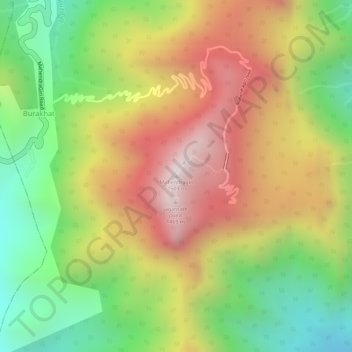
Name: Mahendragiri topographic map, elevation, terrain.
Location: Mahendragiri, Burakhat, Ramagiri, Gajapati, Odisha, India (18.96629 84.36479 18.96639 84.36489)
Average elevation: 1,108 m
Minimum elevation: 711 m
Maximum elevation: 1,494 m
Thank you for supporting this site ❤️
Make a donation
Make a donation