
Abfrutt topographic map
Interactive map
Click on the map to display elevation.
About this map
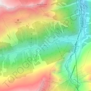
Name: Abfrutt topographic map, elevation, terrain.
Location: Abfrutt, Göschenen, Uri, 6487, Suisse (46.64534 8.54942 46.68534 8.58942)
Average elevation: 1,657 m
Minimum elevation: 966 m
Maximum elevation: 2,572 m
Other topographic maps
Click on a map to view its topography, its elevation and its terrain.
Sustenhorn
Sustenhorn, Göschenen, Uri, 6487, Suisse
Average elevation: 2,857 m