
Thank you for supporting this site ❤️
Make a donation
Make a donation
Cochas Grande topographic map
Click on the map to display elevation.
Thank you for supporting this site ❤️
Make a donation
Make a donation
About this map
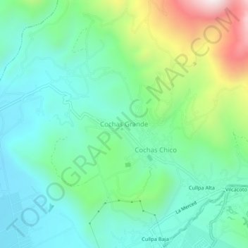
Name: Cochas Grande topographic map, elevation, terrain.
Location: Cochas Grande, El Tambo, Huancayo, Junín, 12002, Perú (-12.02257 -75.22000 -11.98257 -75.18000)
Average elevation: 3,514 m
Minimum elevation: 3,290 m
Maximum elevation: 4,112 m
Thank you for supporting this site ❤️
Make a donation
Make a donation
Other topographic maps
Click on a map to view its topography, its elevation and its terrain.