
Thank you for supporting this site ❤️
Make a donation
Make a donation
17th district topographic map
Click on the map to display elevation.
Thank you for supporting this site ❤️
Make a donation
Make a donation
About this map
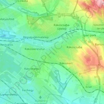
Name: 17th district topographic map, elevation, terrain.
Location: 17th district, Budapest, Central Hungary, Hungary (47.43631 19.19597 47.51542 19.33493)
Average elevation: 159 m
Minimum elevation: 120 m
Maximum elevation: 278 m
Thank you for supporting this site ❤️
Make a donation
Make a donation
Other topographic maps
Click on a map to view its topography, its elevation and its terrain.