Geolocate

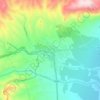
Oued Za topographic map

Click on the map to display elevation.

About this map

Name: Oued Za topographic map, elevation, terrain.

Location: Oued Za, Oriental, Maroc (34.12408 -3.03839 34.55827 -2.12141)

Average elevation: 757 m

Minimum elevation: 170 m

Maximum elevation: 1,708 m

Other topographic maps

Click on a map to view its topography, its elevation and its terrain.

Azrou

Maroc > Oriental > Cercle du Rif Sud > Talilit

Average elevation: 523 m

Bou Maad

Maroc > Oriental > Cercle du Rif Nord > Boudinar

Average elevation: 235 m

Driouch

Maroc > Oriental

Average elevation: 294 m

Anoual

Maroc > Oriental > Cercle de Talsint > Bouchaouene

Average elevation: 1,209 m

Kassita

Maroc > Oriental > Cercle du Rif Sud > Tsaft

Average elevation: 759 m

Azrou

Maroc > Oriental > Cercle du Rif Nord > Trougout

Average elevation: 237 m

Azrou

Maroc > Oriental > Cercle du Rif Nord > Trougout

Average elevation: 237 m

Kassita

Maroc > Oriental > Cercle du Rif Sud > Tsaft

Average elevation: 759 m