
Trigás topographic map
Interactive map
Click on the map to display elevation.
About this map
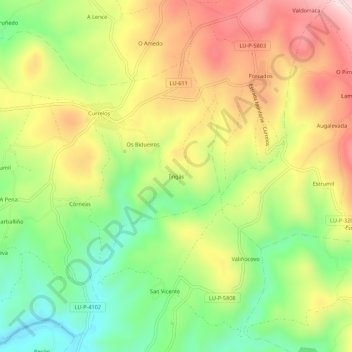
Name: Trigás topographic map, elevation, terrain.
Location: Trigás, Lugo, Galicia, 27543, España (42.65211 -7.65573 42.69211 -7.61573)
Average elevation: 544 m
Minimum elevation: 382 m
Maximum elevation: 724 m