
Mandal topographic map
Interactive map
Click on the map to display elevation.
About this map
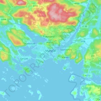
Name: Mandal topographic map, elevation, terrain.
Location: Mandal, Lindesnes, Agder, 4514, Noorwegen (57.98682 7.41348 58.06682 7.49348)
Average elevation: 38 m
Minimum elevation: -7 m
Maximum elevation: 202 m