
Thank you for supporting this site ❤️
Make a donation
Make a donation
Kejadian Lom topographic map
Click on the map to display elevation.
Thank you for supporting this site ❤️
Make a donation
Make a donation
About this map
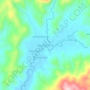
Name: Kejadian Lom topographic map, elevation, terrain.
Location: Kejadian Lom, Tanggamus, Lampung, Sumatra, Indonesia (-5.66413 104.91317 -5.62413 104.95317)
Average elevation: 85 m
Minimum elevation: 5 m
Maximum elevation: 350 m
Thank you for supporting this site ❤️
Make a donation
Make a donation
Other topographic maps
Click on a map to view its topography, its elevation and its terrain.