
Schilde topographic map
Interactive map
Click on the map to display elevation.
About this map
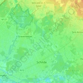
Name: Schilde topographic map, elevation, terrain.
Location: Schilde, Anvers, Flandre, Belgique (51.21978 4.52935 51.29565 4.63314)
Average elevation: 11 m
Minimum elevation: 1 m
Maximum elevation: 30 m