
Thank you for supporting this site ❤️
Make a donation
Make a donation
Tanjung Pala topographic map
Click on the map to display elevation.
Thank you for supporting this site ❤️
Make a donation
Make a donation
About this map
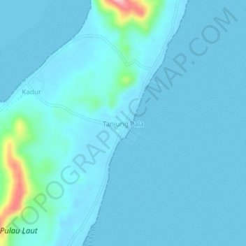
Name: Tanjung Pala topographic map, elevation, terrain.
Location: Tanjung Pala, Natuna, Riau Islands, Sumatra, Indonesia (4.71965 107.97674 4.75965 108.01674)
Average elevation: 14 m
Minimum elevation: -2 m
Maximum elevation: 173 m
Thank you for supporting this site ❤️
Make a donation
Make a donation
Other topographic maps
Click on a map to view its topography, its elevation and its terrain.