
Thank you for supporting this site ❤️
Make a donation
Make a donation
Altos de Cerro Azul topographic map
Click on the map to display elevation.
Thank you for supporting this site ❤️
Make a donation
Make a donation
About this map
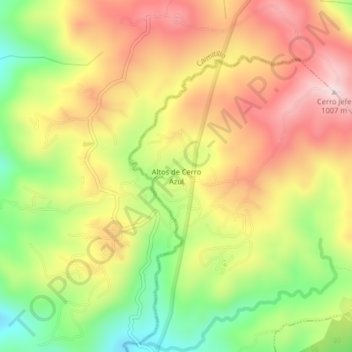
Name: Altos de Cerro Azul topographic map, elevation, terrain.
Location: Altos de Cerro Azul, 24 de Diciembre, Distrito Panamá, Panamá (9.20030 -79.42146 9.24030 -79.38146)
Average elevation: 792 m
Minimum elevation: 565 m
Maximum elevation: 1,000 m
Thank you for supporting this site ❤️
Make a donation
Make a donation
Other topographic maps
Click on a map to view its topography, its elevation and its terrain.