
Thank you for supporting this site ❤️
Make a donation
Make a donation
Zofingen topographic map
Click on the map to display elevation.
Thank you for supporting this site ❤️
Make a donation
Make a donation
About this map
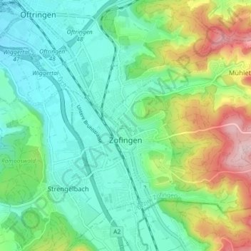
Name: Zofingen topographic map, elevation, terrain.
Location: Zofingen, Bezirk Zofingen, Aargau, Switzerland (47.27449 7.92901 47.30800 8.00018)
Average elevation: 482 m
Minimum elevation: 407 m
Maximum elevation: 662 m
Thank you for supporting this site ❤️
Make a donation
Make a donation