
Hafelekar topographic map
Interactive map
Click on the map to display elevation.
About this map
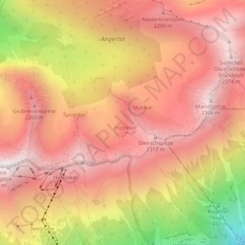
Name: Hafelekar topographic map, elevation, terrain.
Location: Hafelekar, Arzl, Innsbruck, Tirol, 6020, Österreich (47.31411 11.38712 47.32029 11.39526)
Average elevation: 1,964 m
Minimum elevation: 1,139 m
Maximum elevation: 2,395 m
Other topographic maps
Click on a map to view its topography, its elevation and its terrain.
Innsbruck
Österreich > Tirol > Innsbruck
Innsbruck, Statutarstadt Innsbruck, Tirol, Österreich
Average elevation: 611 m
Inn
Österreich > Tirol > Innsbruck > Gemeinde Kematen in Tirol
Inn, Innsbruck, Gemeinde Kematen in Tirol, Bezirk Innsbruck-Land, Tirol, 6175, Österreich
Average elevation: 899 m