
Thank you for supporting this site ❤️
Make a donation
Make a donation
South Brewster topographic map
Click on the map to display elevation.
Thank you for supporting this site ❤️
Make a donation
Make a donation
About this map
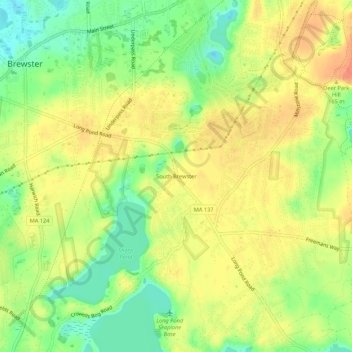
Name: South Brewster topographic map, elevation, terrain.
Average elevation: 26 m
Minimum elevation: 0 m
Maximum elevation: 47 m
Thank you for supporting this site ❤️
Make a donation
Make a donation
Other topographic maps
Click on a map to view its topography, its elevation and its terrain.
Cape Cod Museum Of Natural History
United States > Massachusetts > Barnstable County > Brewster > West Brewster
Average elevation: 11 m