
Coblence topographic map
Interactive map
Click on the map to display elevation.
About this map
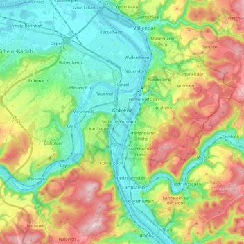
Name: Coblence topographic map, elevation, terrain.
Location: Coblence, Rhénanie-Palatinat, 56068, Allemagne (50.28300 7.47825 50.40969 7.69644)
Average elevation: 181 m
Minimum elevation: 57 m
Maximum elevation: 398 m