
Ljungbyholm topographic map
Interactive map
Click on the map to display elevation.
About this map
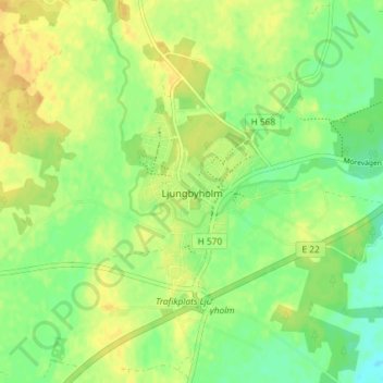
Name: Ljungbyholm topographic map, elevation, terrain.
Location: Ljungbyholm, Kalmar, Comté de Kalmar, Götaland, Suède (56.61398 16.14838 56.65398 16.18838)
Average elevation: 14 m
Minimum elevation: 0 m
Maximum elevation: 25 m