山手台西二丁目 topographic map
Interactive map
Click on the map to display elevation.
About this map
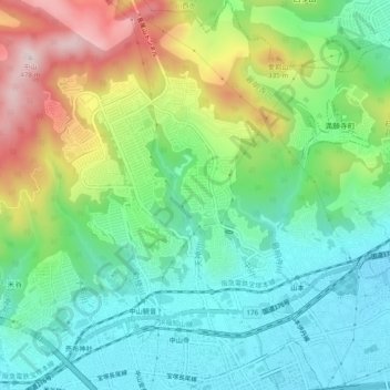
Name: 山手台西二丁目 topographic map, elevation, terrain.
Average elevation: 170 m
Minimum elevation: 29 m
Maximum elevation: 457 m

Click on the map to display elevation.
Name: 山手台西二丁目 topographic map, elevation, terrain.
Average elevation: 170 m
Minimum elevation: 29 m
Maximum elevation: 457 m