
Clos du Doubs topographic map
Interactive map
Click on the map to display elevation.
About this map
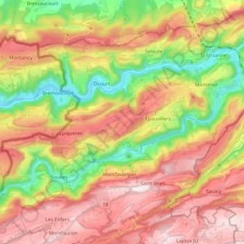
Name: Clos du Doubs topographic map, elevation, terrain.
Location: Clos du Doubs, District de Porrentruy, Jura, Suisse (47.30021 7.00650 47.36697 7.17291)
Average elevation: 744 m
Minimum elevation: 414 m
Maximum elevation: 1,059 m