
Make a donation
Gallitzin topographic map
Click on the map to display elevation.
Make a donation
Gallitzin
Gallitzin has the tenth-highest elevation of towns in Pennsylvania, at 2,167 feet (661 m).
Make a donation
About this map
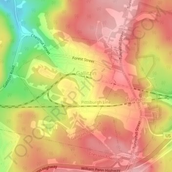
Name: Gallitzin topographic map, elevation, terrain.
Location: Gallitzin, Cambria County, Pennsylvania, United States (40.47253 -78.56611 40.48799 -78.54560)
Average elevation: 683 m
Minimum elevation: 583 m
Maximum elevation: 736 m
Make a donation
Other topographic maps
Click on a map to view its topography, its elevation and its terrain.
Saint Boniface
United States > Pennsylvania > Cambria County > Elder Township
Average elevation: 593 m
Make a donation
Beaver Valley
United States > Pennsylvania > Cambria County > Clearfield Township
Average elevation: 492 m
Saint Benedict
United States > Pennsylvania > Cambria County > West Carroll Township
Average elevation: 582 m
Make a donation
South Fork of the Little Conemaugh River
United States > Pennsylvania > Cambria County > Croyle Township > Rockville
Average elevation: 535 m
Make a donation
Make a donation