
Thank you for supporting this site ❤️
Make a donation
Make a donation
Las Heras topographic map
Click on the map to display elevation.
Thank you for supporting this site ❤️
Make a donation
Make a donation
About this map
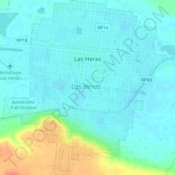
Name: Las Heras topographic map, elevation, terrain.
Location: Las Heras, Deseado, Santa Cruz Province, Argentina (-46.57119 -68.96388 -46.52610 -68.89957)
Average elevation: 339 m
Minimum elevation: 330 m
Maximum elevation: 375 m
Thank you for supporting this site ❤️
Make a donation
Make a donation
Other topographic maps
Click on a map to view its topography, its elevation and its terrain.