
Thank you for supporting this site ❤️
Make a donation
Make a donation
Collinsville topographic map
Click on the map to display elevation.
Thank you for supporting this site ❤️
Make a donation
Make a donation
About this map
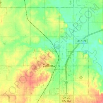
Name: Collinsville topographic map, elevation, terrain.
Location: Collinsville, Tulsa, Oklahoma, United States (36.33642 -95.92100 36.42375 -95.79397)
Average elevation: 197 m
Minimum elevation: 174 m
Maximum elevation: 229 m
Thank you for supporting this site ❤️
Make a donation
Make a donation
Other topographic maps
Click on a map to view its topography, its elevation and its terrain.