
Thank you for supporting this site ❤️
Make a donation
Make a donation
Buta topographic map
Click on the map to display elevation.
Thank you for supporting this site ❤️
Make a donation
Make a donation
About this map
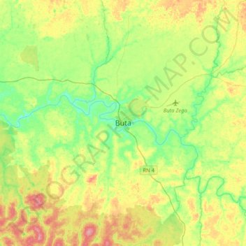
Name: Buta topographic map, elevation, terrain.
Location: Buta, Lower Uele, Democratic Republic of the Congo (2.63326 24.56871 2.95326 24.88871)
Average elevation: 422 m
Minimum elevation: 386 m
Maximum elevation: 478 m
Thank you for supporting this site ❤️
Make a donation
Make a donation
Other topographic maps
Click on a map to view its topography, its elevation and its terrain.