
Thank you for supporting this site ❤️
Make a donation
Make a donation
Boston Harbor topographic map
Click on the map to display elevation.
Thank you for supporting this site ❤️
Make a donation
Make a donation
About this map
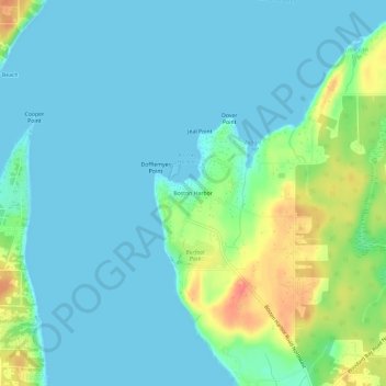
Name: Boston Harbor topographic map, elevation, terrain.
Location: Boston Harbor, Thurston County, Washington, United States (47.11855 -122.92167 47.15855 -122.88167)
Average elevation: 13 m
Minimum elevation: 0 m
Maximum elevation: 57 m
Thank you for supporting this site ❤️
Make a donation
Make a donation