
Thank you for supporting this site ❤️
Make a donation
Make a donation
Shyala topographic map
Click on the map to display elevation.
Thank you for supporting this site ❤️
Make a donation
Make a donation
About this map
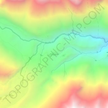
Name: Shyala topographic map, elevation, terrain.
Location: Shyala, Chum Nubri, Gorkha, Gandaki Province, Nepal (28.55419 84.65260 28.59419 84.69260)
Average elevation: 3,766 m
Minimum elevation: 3,047 m
Maximum elevation: 4,684 m
Thank you for supporting this site ❤️
Make a donation
Make a donation
Other topographic maps
Click on a map to view its topography, its elevation and its terrain.