
Orléans topographic map
Interactive map
Click on the map to display elevation.
About this map
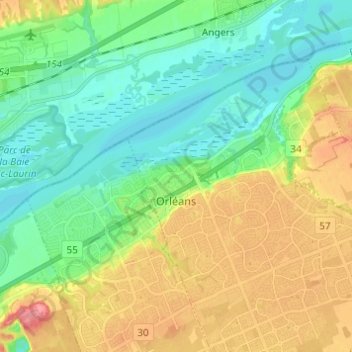
Name: Orléans topographic map, elevation, terrain.
Average elevation: 66 m
Minimum elevation: 38 m
Maximum elevation: 113 m
Inversement, le sud (rive gauche) présente une légère dépression autour de 95 mètres d'altitude (à Saint-Marceau) entre la Loire et le Loiret. Situé dans le lit majeur de la Loire, ce secteur est classé en zone inondable.
Other topographic maps
Click on a map to view its topography, its elevation and its terrain.
Cumberland
Canada > Ontario > Ottawa > Cumberland
Cumberland, Ottawa, Est de l'Ontario, Ontario, Canada
Average elevation: 75 m
Cumberland
Canada > Ontario > Ottawa > Cumberland
Cumberland, Ottawa, Eastern Ontario, Ontario, Canada
Average elevation: 75 m