
Dirang topographic map
Click on the map to display elevation.
About this map
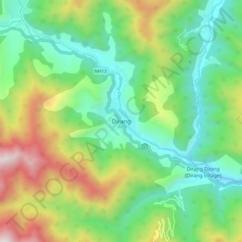
Name: Dirang topographic map, elevation, terrain.
Location: Dirang, Dirang ADC, West Kameng, Arunachal Pradesh, India (27.32008 92.20121 27.40008 92.28121)
Average elevation: 2,000 m
Minimum elevation: 1,483 m
Maximum elevation: 3,053 m
Other topographic maps
Click on a map to view its topography, its elevation and its terrain.