
Zervreilahorn topographic map
Interactive map
Click on the map to display elevation.
About this map
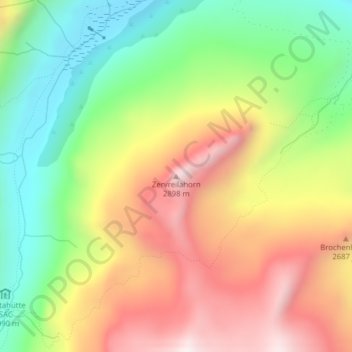
Name: Zervreilahorn topographic map, elevation, terrain.
Location: Zervreilahorn, Vals, Surselva, Graubünden, 7132, Schweiz (46.55053 9.06078 46.55063 9.06088)
Average elevation: 2,400 m
Minimum elevation: 1,980 m
Maximum elevation: 2,883 m
Other topographic maps
Click on a map to view its topography, its elevation and its terrain.
Fanellhorn
Schweiz > Graubünden > Vals
Fanellhorn, Vals, Surselva, Graubünden, 7132, Schweiz
Average elevation: 2,673 m