
Duisburg topographic map
Interactive map
Click on the map to display elevation.
About this map
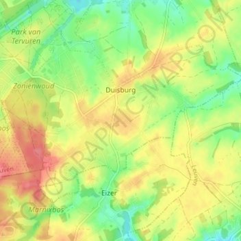
Name: Duisburg topographic map, elevation, terrain.
Location: Duisburg, Tervuren, Leuven, Vlaams-Brabant, Vlaanderen, België (50.79678 4.52111 50.82516 4.58642)
Average elevation: 85 m
Minimum elevation: 51 m
Maximum elevation: 119 m
Other topographic maps
Click on a map to view its topography, its elevation and its terrain.