
Автозаводский район topographic map
Interactive map
Click on the map to display elevation.
About this map
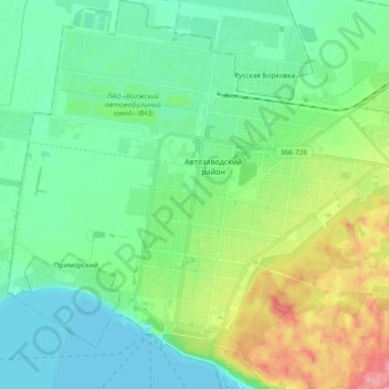
Name: Автозаводский район topographic map, elevation, terrain.
Average elevation: 77 m
Minimum elevation: 49 m
Maximum elevation: 153 m
Other topographic maps
Click on a map to view its topography, its elevation and its terrain.
Togliatti
Russie > Oblast de Samara > Togliatti
Togliatti, городской округ Тольятти, Oblast de Samara, District fédéral de la Volga, Russie
Average elevation: 98 m