
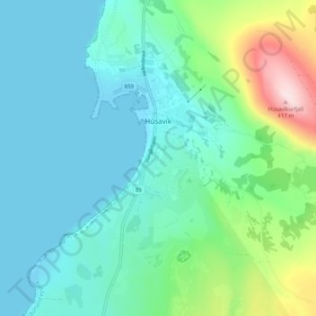
Húsavík topographic map
Interactive map
Click on the map to display elevation.
About this map
Name: Húsavík topographic map, elevation, terrain.
Location: Húsavík, Norðurþing, Northeastern Region, 640, Iceland (66.01875 -17.37583 66.05848 -17.31777)
Average elevation: 84 m
Minimum elevation: -1 m
Maximum elevation: 407 m
Other topographic maps
Click on a map to view its topography, its elevation and its terrain.
Dettifoss
Dettifoss, Norðurþing, Northeastern Region, Iceland
Average elevation: 341 m
Raufarhöfn
Raufarhöfn, Norðurþing, Northeastern Region, 675, Iceland
Average elevation: 13 m