
Thank you for supporting this site ❤️
Make a donation
Make a donation
Camana topographic map
Click on the map to display elevation.
Thank you for supporting this site ❤️
Make a donation
Make a donation
About this map
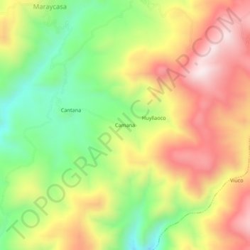
Name: Camana topographic map, elevation, terrain.
Location: Camana, Quicacha, Province of Caravelí, Arequipa, Peru (-15.49378 -73.67080 -15.45378 -73.63080)
Average elevation: 3,438 m
Minimum elevation: 3,136 m
Maximum elevation: 3,749 m
Thank you for supporting this site ❤️
Make a donation
Make a donation