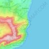
Gurnard topographic map
Click on the map to display elevation.
About this map

Name: Gurnard topographic map, elevation, terrain.
Location: Gurnard, Isle of Wight, England, United Kingdom (50.73566 -1.34852 50.76510 -1.31224)
Average elevation: 31 m
Minimum elevation: -1 m
Maximum elevation: 68 m
Other topographic maps
Click on a map to view its topography, its elevation and its terrain.


Littleton Down
United Kingdom > England > Isle of Wight > Ventnor > Bonchurch
Average elevation: 111 m