
Zammenau topographic map
Interactive map
Click on the map to display elevation.
About this map
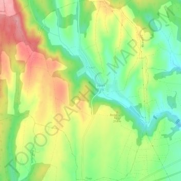
Name: Zammenau topographic map, elevation, terrain.
Average elevation: 196 m
Minimum elevation: 139 m
Maximum elevation: 264 m
Other topographic maps
Click on a map to view its topography, its elevation and its terrain.
Moosburg
Moosburg, Keszthelyi járás, Komitat Zala, Transdanubien, 8392, Ungarn
Average elevation: 111 m
Nemesbük
Ungarn > Komitat Zala > Nemesbük
Nemesbük, Keszthelyi járás, Komitat Zala, Westtransdanubien, Transdanubien, 8371, Ungarn
Average elevation: 198 m