
Täschhorn topographic map
Interactive map
Click on the map to display elevation.
About this map
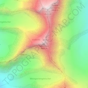
Name: Täschhorn topographic map, elevation, terrain.
Location: Täschhorn, Täsch, Visp, Wallis, 3929, Schweiz (46.08338 7.85714 46.08348 7.85724)
Average elevation: 3,723 m
Minimum elevation: 3,058 m
Maximum elevation: 4,538 m
Other topographic maps
Click on a map to view its topography, its elevation and its terrain.
Rimpfischhorn
Rimpfischhorn, Täsch, Visp, Wallis, 3929, Schweiz
Average elevation: 3,630 m
Adlergletscher
Adlergletscher, Schwarzgrat, Täsch, Visp, Wallis, 3929, Schweiz
Average elevation: 3,500 m
Findelgletscher
Findelgletscher, Schwarzgrat, Täsch, Visp, Wallis, 3929, Schweiz
Average elevation: 3,268 m