
Bec des Etagnes topographic map
Interactive map
Click on the map to display elevation.
About this map
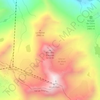
Name: Bec des Etagnes topographic map, elevation, terrain.
Location: Bec des Etagnes, Nendaz, Conthey, Valais, 1997, Suisse (46.08922 7.31639 46.08932 7.31649)
Average elevation: 2,796 m
Minimum elevation: 2,168 m
Maximum elevation: 3,319 m
Other topographic maps
Click on a map to view its topography, its elevation and its terrain.
Lac des Vaux
Lac des Vaux, Chassoure-Tortin, La Tsa, Nendaz, Conthey, Valais, 1997, Suisse
Average elevation: 2,471 m