
Make a donation
Arizona City topographic map
Click on the map to display elevation.
Make a donation
Arizona City
Arizona City itself is mostly flat, lying in the Santa Cruz Valley in the center of three low mountain ranges; the Sawtooth Mountains to the south, the Picacho Mountains to the east, and the Casa Grande Mountains to the north. Picacho Peak, a prominent peak with a summit elevation of 3,374 feet (1,028 m), is located approximately 20 miles (32 km) to the southeast adjacent to Interstate 10. Directly to the west of the CDP is the expansive Tohono O'odham Indian Reservation, which stretches 80 miles (130 km) south to the international border with Mexico.
Make a donation
About this map
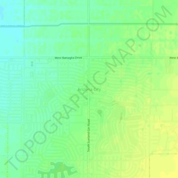
Name: Arizona City topographic map, elevation, terrain.
Location: Arizona City, Pinal County, Arizona, 85123, United States (32.73589 -111.69096 32.77589 -111.65096)
Average elevation: 459 m
Minimum elevation: 449 m
Maximum elevation: 467 m
Make a donation
Other topographic maps
Click on a map to view its topography, its elevation and its terrain.
San Manuel
United States > Arizona > Pinal County
San Manuel is located at 32°36′18″N 110°38′0″W / 32.60500°N 110.63333°W / 32.60500; -110.63333 (32.605048, -110.633340), in the San Pedro River Valley at an elevation of about 3,500 feet (1,100 m). San Manuel is approximately 45 miles (72 km) northeast of Tucson.
Average elevation: 991 m
Kearny
United States > Arizona > Pinal County
Kearny Airport is a general aviation airport located in the southern section of the town. In 2003 it received the Arizona Department of Transportation's Airport of the Year award. The airport has a single asphalt runway, 3,400 feet (1,000 m) in length and 60 feet (18 m) in width, with a field elevation of…
Average elevation: 578 m
Make a donation
Make a donation