
Y Bontnewydd topographic map
Interactive map
Click on the map to display elevation.
About this map
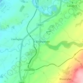
Name: Y Bontnewydd topographic map, elevation, terrain.
Location: Y Bontnewydd, Gwynedd, Gales, LL54 7UR, Reino Unido (53.09411 -4.28681 53.13411 -4.24681)
Average elevation: 58 m
Minimum elevation: 0 m
Maximum elevation: 214 m