
Thank you for supporting this site ❤️
Make a donation
Make a donation
Castelfranco di Sotto topographic map
Click on the map to display elevation.
Thank you for supporting this site ❤️
Make a donation
Make a donation
About this map
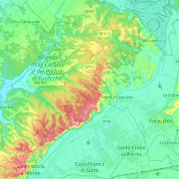
Name: Castelfranco di Sotto topographic map, elevation, terrain.
Location: Castelfranco di Sotto, Pisa, Tuscany, Italy (43.69208 10.64474 43.80619 10.76862)
Average elevation: 34 m
Minimum elevation: 2 m
Maximum elevation: 115 m
Thank you for supporting this site ❤️
Make a donation
Make a donation
Other topographic maps
Click on a map to view its topography, its elevation and its terrain.