
Yamanouchi topographic map
Click on the map to display elevation.
Yamanouchi
Shimotakai District, in northern mountainous Nagano Prefecture, comprises Yamanouchi town, Kijimadaira Village, and Nozawaonsen Village. Yamanouchi is the largest of these. More than 90% of Yamanouchi is covered by mountains and forests. The town measures approximately 39 kilometers east-west and 12 kilometers north-south (266 square kilometers), and has an elevation ranging from 424 meters to 2341 meters. The surrounding area is known for its forest therapy.
About this map
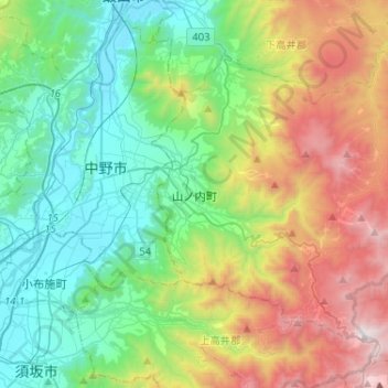
Name: Yamanouchi topographic map, elevation, terrain.
Average elevation: 942 m
Minimum elevation: 305 m
Maximum elevation: 2,303 m