
Thank you for supporting this site ❤️
Make a donation
Make a donation
Wildcat Hills topographic map
Click on the map to display elevation.
Thank you for supporting this site ❤️
Make a donation
Make a donation
About this map
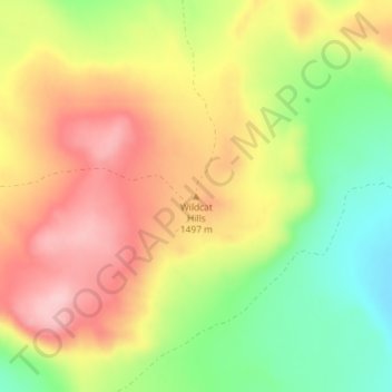
Name: Wildcat Hills topographic map, elevation, terrain.
Location: Wildcat Hills, Box Elder County, Utah, United States (41.84209 -113.01809 41.84219 -113.01799)
Average elevation: 1,464 m
Minimum elevation: 1,371 m
Maximum elevation: 1,546 m
Thank you for supporting this site ❤️
Make a donation
Make a donation
Other topographic maps
Click on a map to view its topography, its elevation and its terrain.