
Hansez topographic map
Interactive map
Click on the map to display elevation.
About this map
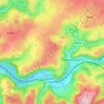
Name: Hansez topographic map, elevation, terrain.
Location: Hansez, Olne, Verviers, Luik, Wallonië, 4877, België (50.55654 5.70528 50.59654 5.74528)
Average elevation: 194 m
Minimum elevation: 94 m
Maximum elevation: 297 m